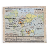
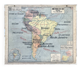
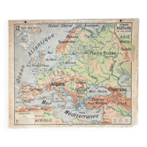
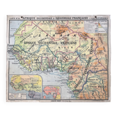
Old school map Vidal-Lablache 322, 1960 - World map, Out

- Dimensions :
- H100 x W120
- Color :
- multicolour
- Material :
- paper
- Style :
- vintage
🌐 Old school geography map representing the world (planisphere), France, and overseas departments and territories 🌐 Collection Vidal-Lablache original. 1960s. Librairie Armand Colin, 103 Bd Saint-Michel, Paris. Imprimeries Michard, Paris. Print run 151. Polychrome cardboard poster. Dimensions: 120 × 100 cm. Front: 22 planisphere, world (Europe, Asia, Africa, America, Oceania, Pacific, Atlantic...) Back: 22 bis blank map. Medallions: Legend, The seas, The globe, Europe, The overseas departments and territories. Good condition: fabric border and brass eyelets present, stains on the edges, other small signs of use (see photo). Beautiful patina, preserved colours, and historical interest. Dating: after 1958. The term "French colonies" dates from before 1914; "The French Empire" from the 1930s; "The French Union" is inscribed in the 1946 Constitution; "The French Community" in that of 1958. The map 322 titled simply "Planisphere" (+ Overseas) is the latest in the series. Ideal for vintage decoration, collection, or original gift! FREE SHIPPING FOR THIS MAP (in France, via Relais Colis or Colissimo). For abroad, costs will be calculated based on the destination (international Colissimo). Map carefully shipped in a thick cardboard prism in France or abroad. All types of payment accepted: bank transfer, PayPal, cheque, or through the site. For multiple posters and maps purchased from my listings. Over 300 vintage posters and rare maps to discover on VintAffich: Auzoux, Belin, Boucau, Bourrelier, Bruley, Brunhes, CDN, Colin, Delagrave, Deyrolle, Galtier-Boissière, Hachette, Hatier, Kaeppelin, La Pie, Maltruchot, Mézières, MDI, Nathan, Ogé, Peyre, Rossignol, Scolathèque, Teissier, Trotignon, Varon, Vidal-Lablache. 22VL16.
Earth globes & geographical maps: other similar vintage pieces
Discover more similar items