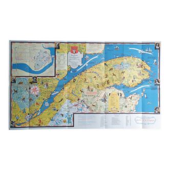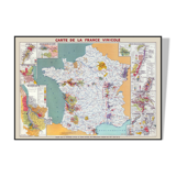


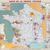
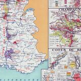
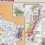
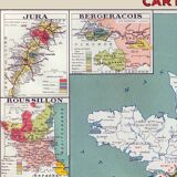


Wine Map of France - Vintage Map Showing Wine and Wine Regions 100x70 cm
🙈 Oops, this product is already sold or unavailable. Discover our 1500 new products or products similar to this item !
- Dimensions :
- H70 x W100
- Color :
- beige
- Material :
- paper
- Style :
- vintage
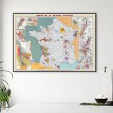
Map of France Wine Regions, Restored Vintage Map of France Showing Its Wine Regions, Published in 1945 by Louis Larmat. Beautiful Vintage Map of France and its Famous Appellations, Bordeaux and its Chateaux, Loire Valley, Burgundy, Alsace, Jura, Côtes du Rhone, Rhone Valley, Languedoc-Roussillon, Saint-Emilion, Saint-Estèphe, Graves, Saint-Amour, Chablis, Pouilly-Fuissé, Hermitage, Chateauneuf du Pape, Banyuls, Riesling, Gewurztraminer, etc. Museum Quality Poster Printed on Heavyweight Matte Paper. • Paper Thickness: 10.3 Mil • Paper Weight: 189 Gsm • Opacity: 94% • Paper from Japan. • Size 28 X 40 Inches = 70 × 100 cm.