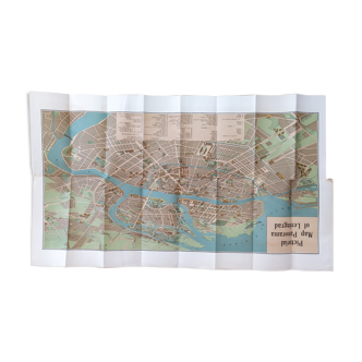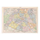
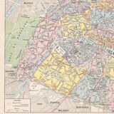
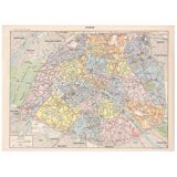


Old map of Paris, late 19th century
- Dimensions :
- H22 x W30 x D0.1
- Color :
- multicolour
- Material :
- paper
- Style :
- vintage
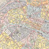
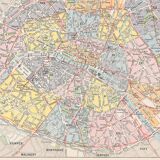
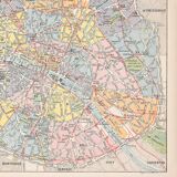
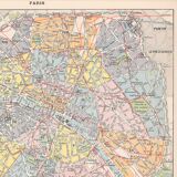
Beautiful geographical engraving of Paris 1897 in color, authentic illustrated plate extracted from a Larousse encyclopedia. Historical cartography, nicely detailed illustration. This map is an original and not a copy or reproduction. Dimensions: height 22.9cm, length 30.9cm. The back is printed. You can frame it to join your wall of frames. Beautiful gift idea for a travel enthusiast or perfect as decoration in your vintage interior (entrance, living room, office, kitchen, bedroom, hallway ...) or for the decoration of a bar, restaurant, business. Paper plate. Very good condition. Keywords: oldmaps maps geography cabinet of curiosities oldschool retro engraving poster business gift idea Christmas birthday antique maps geography history decoration flea market decoration for guest house accommodation vacation rental countryside world planisphere France architecture heritage Eiffel Tower Notre Dame Champs Elysees Trocadero Montmartre.
4.98 ()