


Item 1 of 7
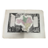
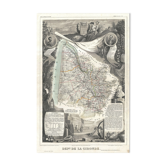
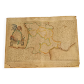
Map of the Rhône - Lyon, Ampère, Jacquart, 23x27cm
€21

Map of the Rhône - Lyon, Ampère, Jacquart, 23x27cm
€21
- Dimensions :
- H27 x W23 x D1
- Color :
- multicolour
- Material :
- paper
- Style :
- classic
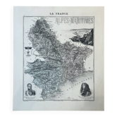
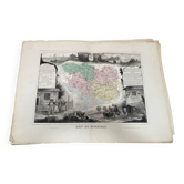
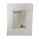
Engraved map of the Rhône department, extracted from the atlas "La France", drawn by A. Vuillemin. It represents the districts of Villefranche and Lyon, with an allegory of Lugdunum, portraits of Ampère and Jacquart in medallions, a statue of Saint Ambrose, and the city's coat of arms. A 19th-century document, rich in historical illustrations related to the city of Lyon and its Roman past. A sought-after piece for enthusiasts of regional cartography and Lyonnaise history. Format: 23.4 X 27 cm. Condition: very good condition with some imperfections, see photos. Carefully packaged and protected delivery, or free collection in Paris and Lyon.
🇫🇷 HPF S.Professional sellerSuper ProSuper Pro : these sellers are experienced and best-rated by our customers.See the shop
317 sales
4.94 ()
Earth globes & geographical maps: other similar vintage pieces
Discover more similar items- -9%
- -25%
- -25%
- -46%
- -25%
- -25%
- -57%
- -14%
- -12%
- -31%
- -48%
- -73%







Item 1 of 20