Sold out


Page 1 of 6
Old Map - Map of Gaul - 1836
This item has found its owner, but other one-of-a-kind items await you. 👇
Discover similar items- Dimensions :
- H32 x W40
- Color :
- white
- Material :
- paper
- Style :
- classic
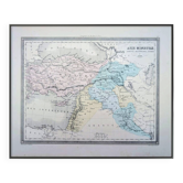
Old map 1836. Hand-colored engraving. Map of gaul divided into roman provinces and including the conquers of the franks, the possessions of the visigoths, those of the ostrogoths and the kingdom of the burgundians, until the beginning of the sixth century, from the "complete atlas of the precise of universal geography" of m. Malte-brun in 1836. Engraved by thierry rue des mathurins saint jacques n°1. Paper dimensions: 40x31.5 cm. Dimensions engraving: 31x23.5 cm. Good general condition for age. Some tasks - normal tarnishing of the paper. Look at the photos to realize the defects.