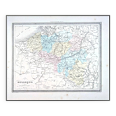
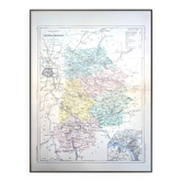
Holland, old map, printed in 1852. Authentic.

- Dimensions :
- H30 x W24
- Color :
- printed
- Material :
- paper
- Style :
- classic
This is an authentic antique map, not a modern reproduction. Here you'll find only original prints that have stood the test of time with a truly patinated appearance. 🧭 Travel back in time and explore Holland (the Netherlands) and its capital, Amsterdam, with this superb, colorful and detailed antique map. Drawn by A. Vuillemin, a French geographer (1812-1886). Printed in Paris (Saint-Denis) in 1852. Maps, planispheres, botanical and anatomical plates, advertising prints, engravings, and photographs of all kinds, for authentic, retro, vintage decor, to treat yourself or others. 📏 Card dimensions: L24cm X H30cm. ⚠️Frame not included⚠️ 📦Fast, protected, and careful shipping. Posters are shipped flat in a plastic sleeve and a rigid cardboard envelope. Careful and personalized packaging. Feel free to ask me to include a personalized message if you would like to gift this order for a special occasion. 🔎 Items are rated in "very good condition" given their age; they obviously show some signs of wear. The photos will allow you to see the actual condition, as the item pictured will be the one shipped; there is no stock. 🚚 Shipping to France and International. 134.
Earth globes & geographical maps: other similar vintage pieces
Discover more similar items- -12%
- -9%
- -11%