Old canvas map of the surroundings of Paris, 1893

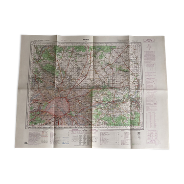
Beautiful old linen-backed map representing the surroundings of Paris, published by Hachette & Cie in 1893. Prepared by the French Map Service for the Ministry of the Interior at a scale of 1: 100, 000, it offers a very detailed representation of Paris and its wide periphery: towns and villages, roads, railways, waterways, woods, and reliefs. The map is printed in colour on paper, cut into panels, and mounted on linen to allow for folding. It retains its original green covers, including one bearing the title "Environs de Paris – Hachette et Cie." A beautiful object of historical cartography, both historical and decorative, allowing one to discover Paris and its surroundings in 1893, before the major transformations and massive urbanisation of the Parisian suburbs in the 20th century. In good antique condition, with signs of use and small marks related to age and folding, visible in the photos. Unfolded dimensions: 62 × 55 cm. Folded dimensions: 19 × 10.7 cm. Weight: 100 g.
Earth globes & geographical maps: other similar vintage pieces
Discover more similar items- -57%
- -46%
- -39%
- -14%
- -76%
- -39%