Sold out


Page 1 of 3
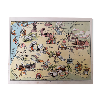
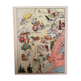
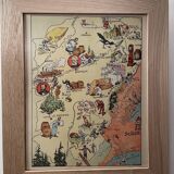
Old poster map of Franche Comté - JP Pinchon
€35
🙈 Oops, this product is already sold or unavailable. Discover our 1500 new products or products similar to this item !
- Dimensions :
- H30 x W24 x D1
- Color :
- multicolour
- Material :
- paper
- Style :
- vintage
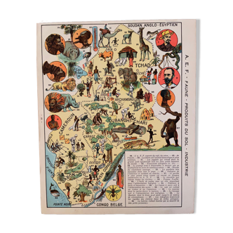
Old map of franche comté, illustrated by émile-joseph-porphyre pinchon (the cartoonist of bécassine), extracted from "les provinces de france illustrées", published by blondel la rougery. Visible signature of j.p. Pinchon. Date: 1927. Dimensions: 23.5 X 29.7 cm. Sold framed (solid wood frame and glass): 45€. Perfect for a child's room. Geography, france, haute saône, doubs, jura, besançon, lons-le-saulnier, vesoul, salins, dôle.
🇫🇷
Mathilde S.
Super Pro
Sellers like this? We'd like to have thousands of them! This seller has fulfilled all of their clients' expectations. Will you be up next?
588 sales
4.97 ()