


Page 1 of 6
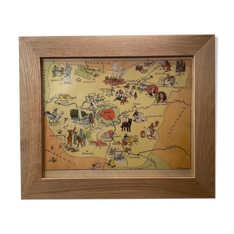
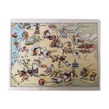
Old illustrated map of Flanders Artois Picardy 1948 - JP Pinchon
€34 €38
🎁 30€ off on your first order with the code SELENCY30.
Learn more
Enjoy €30 off with a minimum order value of €300 (delivery cost excluded).
Old illustrated map of Flanders Artois Picardy 1948 - JP Pinchon
€34 €38
- Color :
- multicolour
- Material :
- paper
- Style :
- vintage
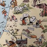
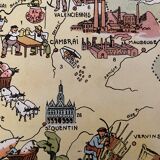
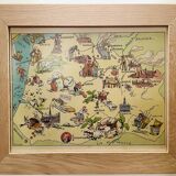
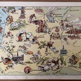
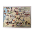
Old map of the regions flanders artois picardy, illustrated by émile-joseph-porphyre pinchon (the cartoonist bécassine), extracted from "the provinces of france illustrated", published by blondel la rougery editions. Visible signature of j.p. Pinchon. Date: 1948. Dimensions: 23.5 X 29.7 cm. To be framed. Perfect for a children's room. Decoration, decoration, vintage, christmas gift idea and country house. Geography, france, amiens, somme, abbeville, saint quentin, aisnes, lille, maubeuge, valenciennes, tourcoing, roubaix, dunkirk, calais, boulogne, arras, pas de calais, nord, béthune, montreuil, hazebrouck, st pol, douai, santerre, cambrai.
🇫🇷
Mathilde S.
Super Pro
Sellers like this? We'd like to have thousands of them! This seller has fulfilled all of their clients' expectations. Will you be up next?
592 sales
4.97 ()