


Item 1 of 11
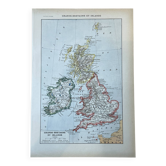
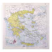
Old map of the British Isles 54x37cm
€22

Old map of the British Isles 54x37cm
€22
- Dimensions :
- H54 x W37 x D1
- Color :
- multicolour
- Material :
- paper
- Style :
- vintage
Map published by the Ch. Delagrave bookstore, Paris, no. 17. Coloured map of the United Kingdom and Ireland at a scale of 1: 3, 000, 000, showing the counties of England, Wales, Scotland, and Ireland, detailed table of administrative divisions, inset of the Shetland Islands. A precise cartographic document, its complete table of counties makes it a valued reference for genealogy and antique map enthusiasts. Dimensions: 54 X 37 cm. Condition: very good. Careful and protected delivery, or free collection in Paris and Lyon.
Earth globes & geographical maps: other similar vintage pieces
Discover more similar items



Item 1 of 20