Sold out


Page 1 of 11
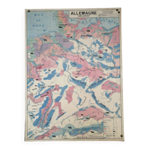
Educational map Aquitaine Basin Pyrenees Jura Alpes Rhone Valley
This item has found its owner, but other one-of-a-kind items await you. 👇
Discover similar items- Dimensions :
- H92 x W80
- Color :
- multicolour
- Material :
- paper
- Style :
- vintage
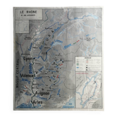
This laminated wall map was published by the maison des instituteurs. It is full of picturesque details illustrating the economy of the france in the 60s. Very decorative, it is in a state of use (the bottom has yellowed and there are marks of folds). On the front: the jura, the alps, the saône and the rhône with dijon, lyon, grenoble, nice. On the back: the aquitaine basin and the pyrenees with bordeaux, toulouse and perpignan. The vineyards of burgundy and bordeaux are enlarged. Perfect to decorate your kitchen if you live in one of these regions!.
Earth globes & geographical maps: other similar vintage pieces
Discover more similar items







Page 1 of 10