


Page 1 of 6
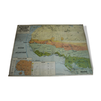
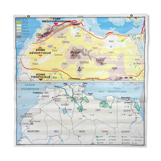
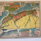
Ancient school map North Africa
€150
Ancient school map North Africa
€150
- Dimensions :
- H102 x W122
- Color :
- multicolour
- Material :
- paper
- Style :
- vintage
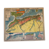
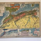
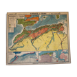
Old school map n°18 "north africa, algeria, tunisia, morocco", physical map, rainfall map, rural dwelling map of the indigenous people of algeria, comparative map of france and french africa, front / n°18 "north africa, algeria, tunisia, morocco", physical map, back. By jean brunhes and paul castelnau librairie hatier – imprimerie gaillac-monrocq et cie de paris dimensions: 122 X 102 cm. General condition: very good condition. Slight traces of wear and tear and nice patina for this card used in class. Presence of hanging eyelets.