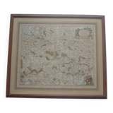
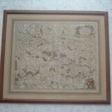
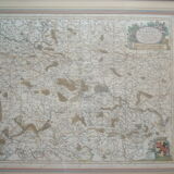
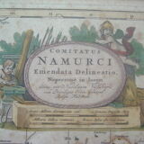
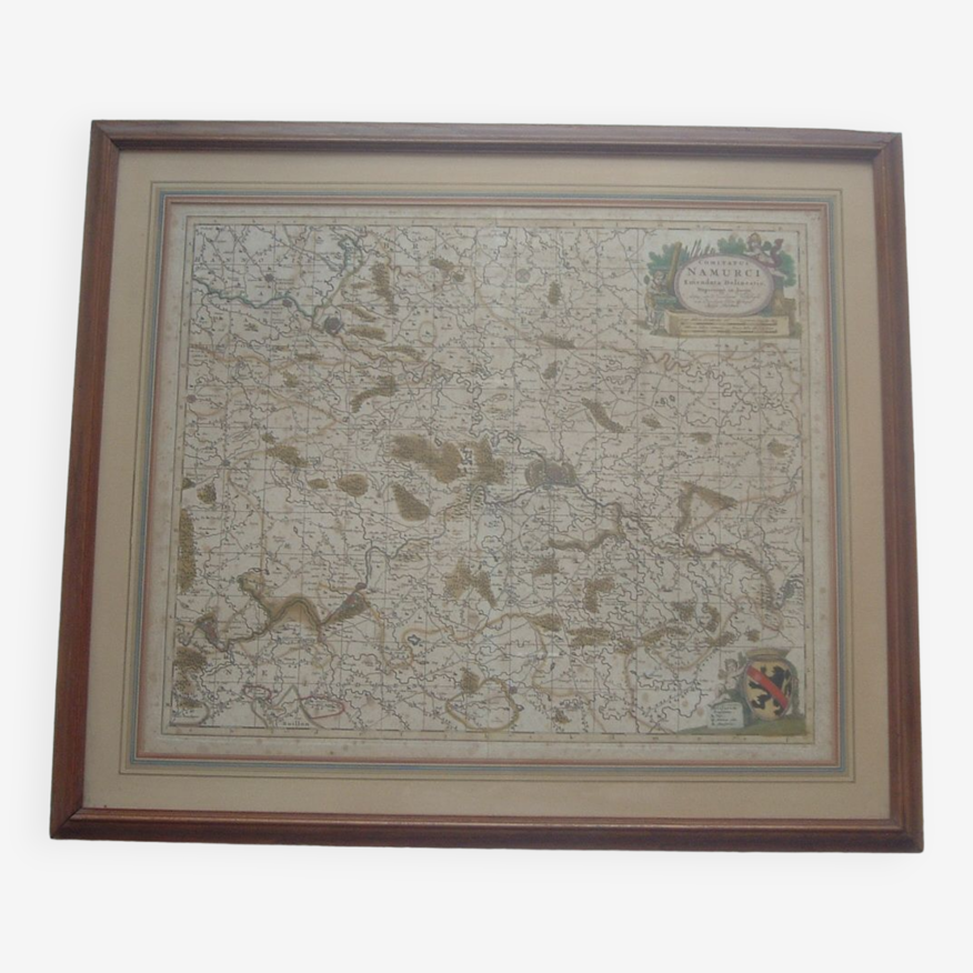
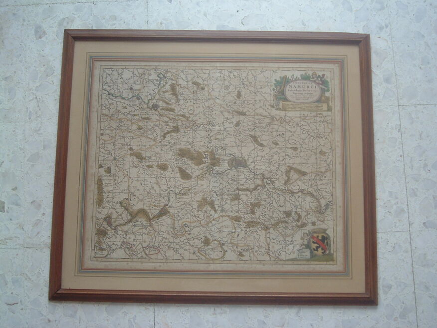
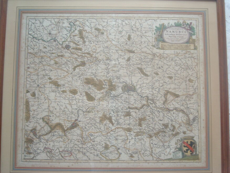
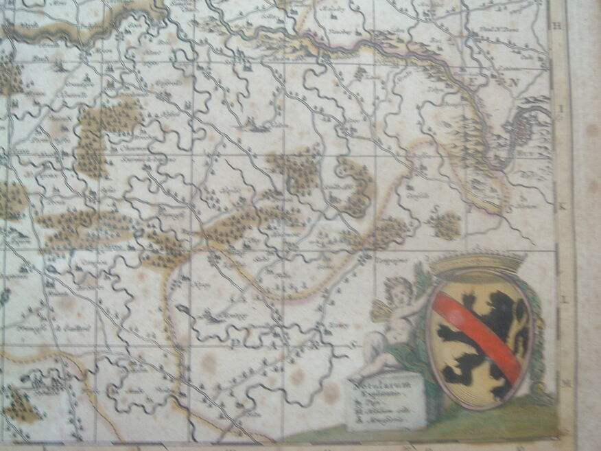
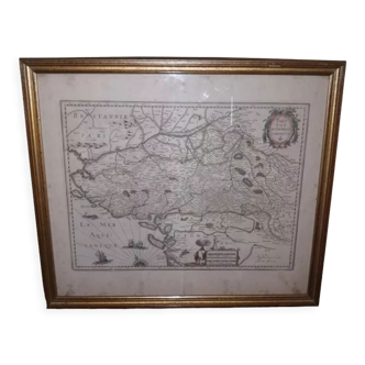
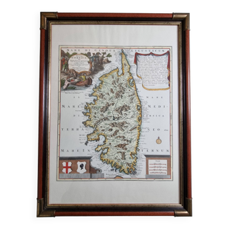
Old map xvii province of namur belgium by visscher, comitatus namurci, atlas minor, frame
- H65 x W74 x D3
- paper
- multicolour
5 ()
Description
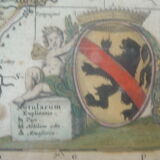
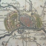
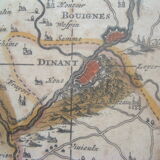
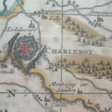
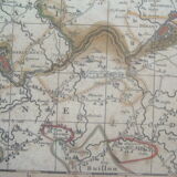
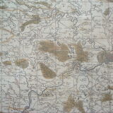
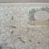
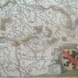
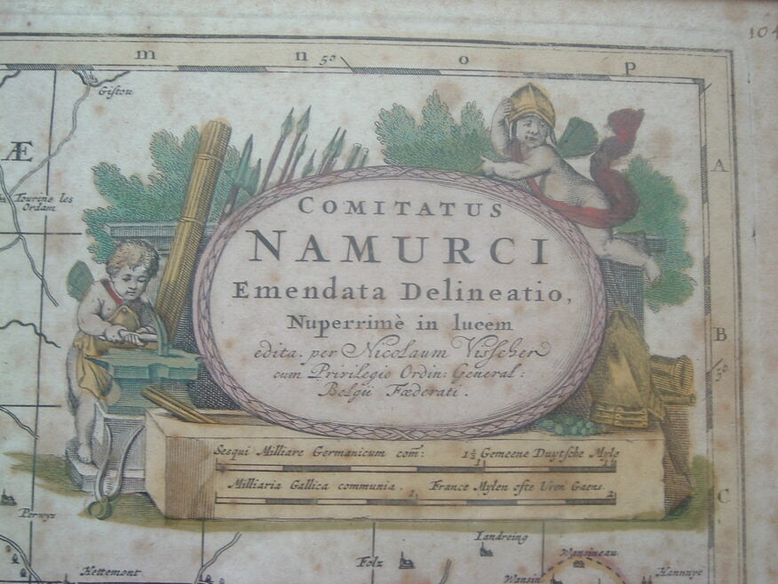
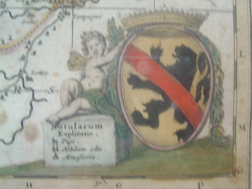
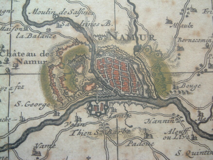
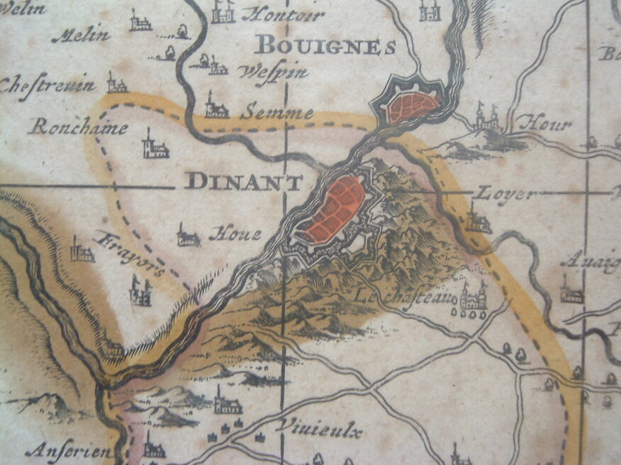
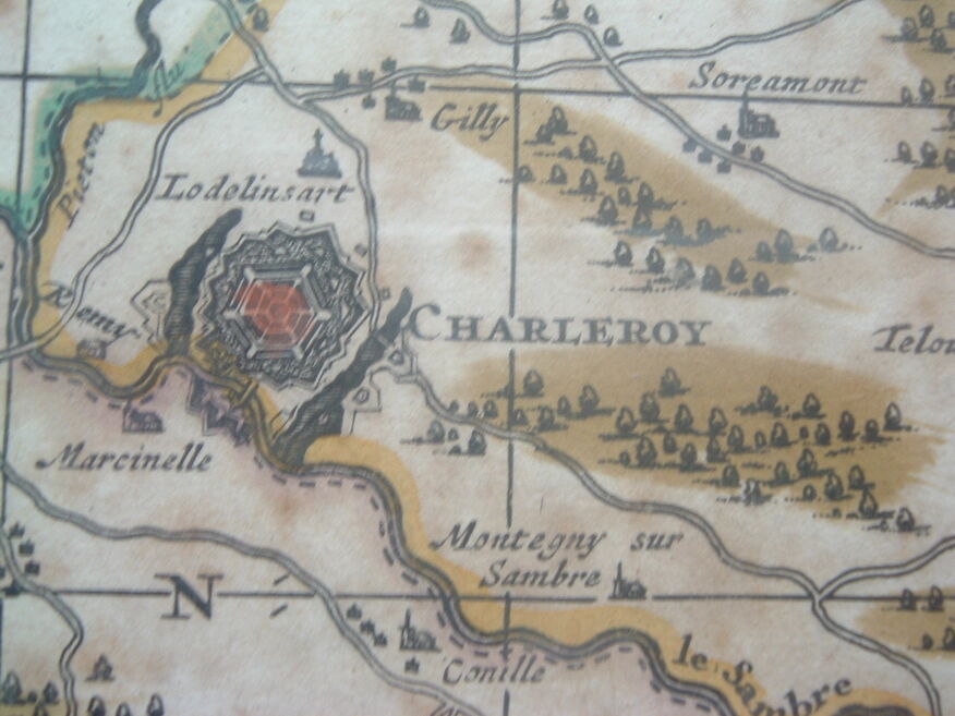
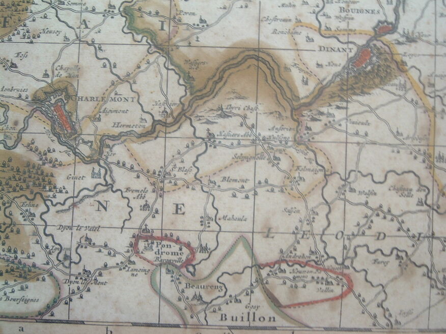
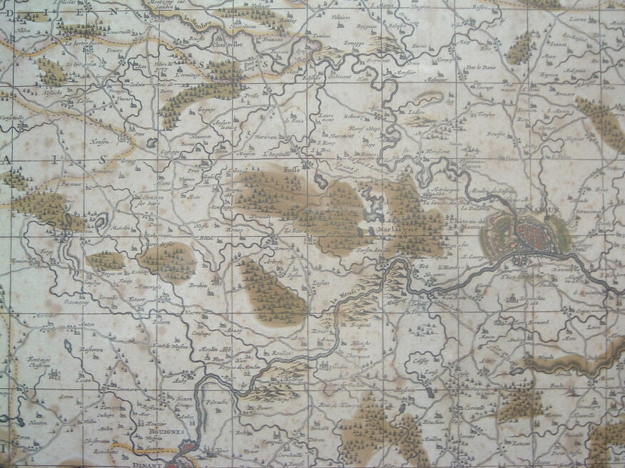
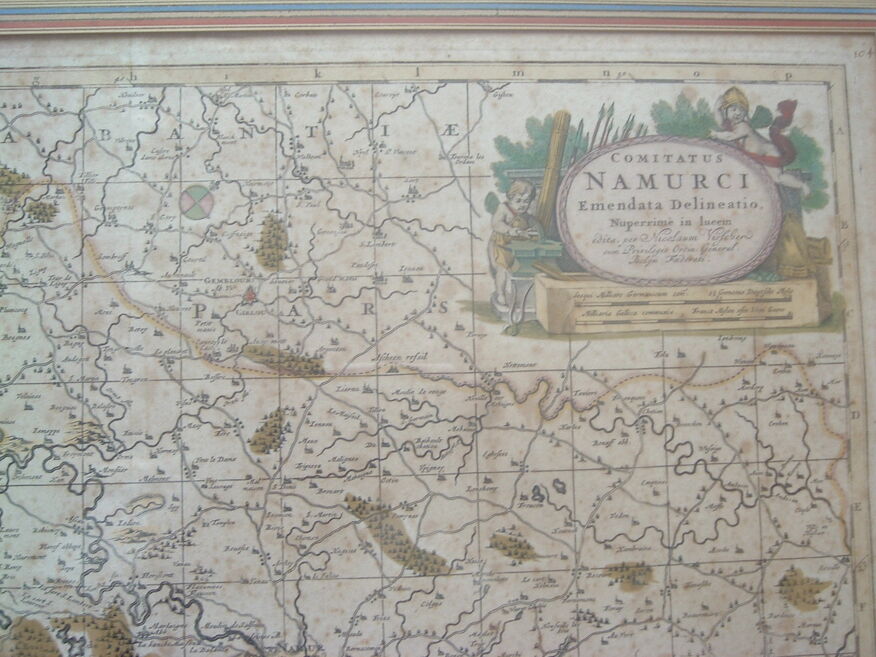
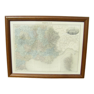
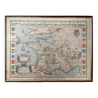
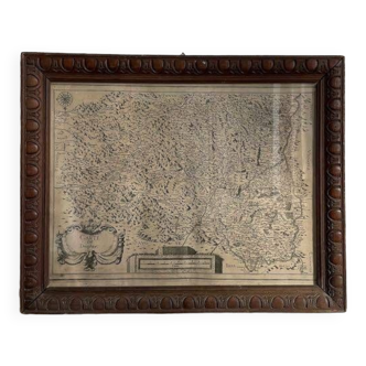
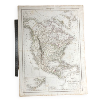
Rare map engraved late seventeenth century (1695) of the province of namur in belgium, revised and edited by nicolas visscher: at the top right a cartouche with the words "comitatus namurci emendata delineatio nuperrime in lucem, edita per nicolaum visscher privilegio ordin. General belgii foederati" above the scale bar (german and french miles). The cartouche is surrounded by cherubs with tools and weapons of war. Bottom right cartouche with the coat of arms of the county of namur (gold, sand lion, armed, lampassé and crowned with gules, with the cotice of the same brochant on the whole) with legend (churches, monasteries etc). The map is enhanced with watercolor. We can see the mark of the engraving plate as well as a vertical central fold (map from an atlas). Fortified cities namur charleroy dinan etc. Dimensions 65 X 74cm in thick wooden frame 3cm and protective glass. Wall attachment system on the back. Packed weight 5kg. Visible freckles but no lack, be. Nicholas visscher the second (1649 - 1709) is a dutch cartographer who published this map in 1695 in his atlas minor at de witt to published in amsterdam in the early eighteenth to the golden age of dutch cartography. Key words: blaeu, jansson, hondius, peter schenk, frédéric de witt, namen belgie, plan, world map, geography, travel.
Ref. : A2XJRCR8
- Dimensions :
- H65 x W74 x D3
- Color :
- multicolour
- Material :
- paper
- Style :
- classic
Return your item within 14 days
Cherry-picked items
Carrefully selected sellers
100% secured payment